


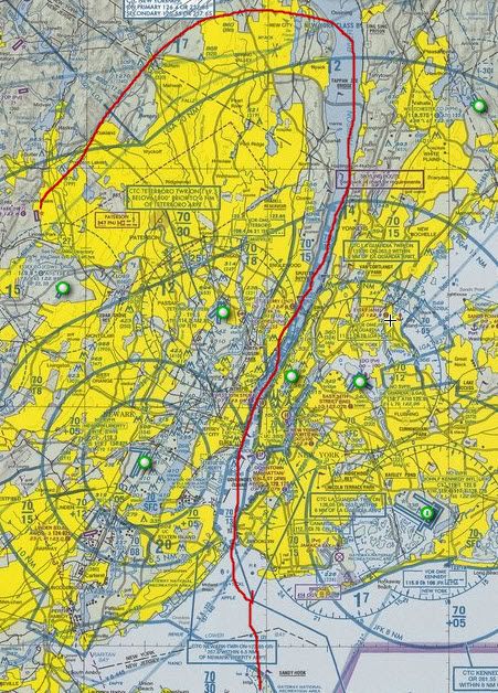
In the summer of 2008 on my sort of annual East Coast tour I had flown into North Jersey to visit my Uncle for a bit at Lincoln Park (N07). After visiting, catching up and getting a great lunch at an on-field resturaunt I started to get ready to fly back to South Jersey to visit my brother in Millville (MIV). Looking at the charts it hit me how close NYC is and the Hudson River VFR route. I had seen a website a few months prior that described flying down the river right through NYC.
http://www.germaise.com/interests/aviation_flyinghudson1.htm
It was right there only a few miles away, the skies were clear, the haze wasn't too bad, why not give it a try. I wandered into the FBO to ask them about any local knowledge on flying it. The lady at the counter talked about the low ceiling you must observe and the traffic pattern and callouts that are given as was metioned at the website I had read. The one thing we checked was whether the Giants had a game going at their home field. At that time they would throw up a TFR during the games. We checked the Giants schedule and sure enough they had a game late in the afternoon. So a call to Flight Service was made. The person I talked to was not aware of any TFR down the river corridor. I mentioned the Giants game and he wasn't even aware that they put up TFRs. So since the calls are recorded I made sure he distinctly said no TFRs during your planned timeframe of heading down the river. With that out of the way I preflighted and donned my skier life vest that I carry whenever I am doing significant water crossings. ( Earlier on my trip I had crossed some water called the Chesapeke Bay.) From the web article apparantly once your on the river and getting downtown there's no where to land and most likely you will be going swimming if you have an engine out. So with that thought in the back of my mind I decided to set off. I planned to fly the river from North to South.
So from Lincoln Park I departed to the northeast to pick up the Hudson River a little south of Stony Point. The visibility was pretty good, after flying on the east coast the last week I was starting to get used to the relatively low vis compared to typical 50mi plus in Colorado. The following photos are from my trip down the Hudson:
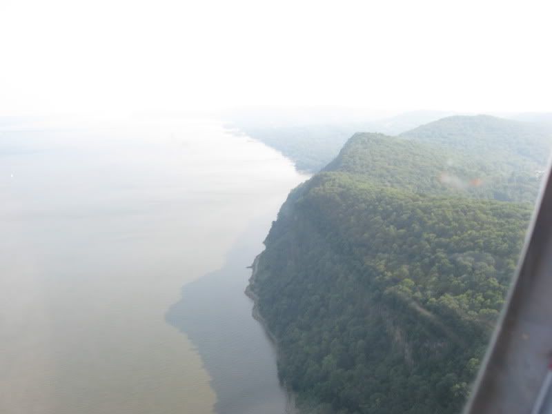
The first thing that suprised me was the dramatic cliffs that are about 300 - 400 feet high as I set up to fly along the west side of the river :
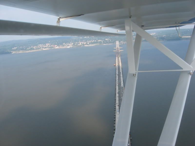
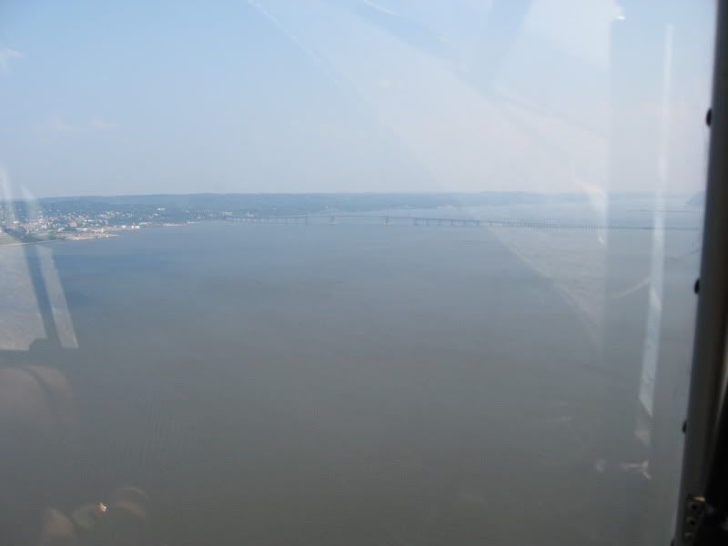
First up was the Tappan Zee bridge in the distant haze. That sort of marks the edge of controlled airspace cielings that are dropping as I proceed, at the bridge you are under LaGuardia airspace with a 3000ft.;
As I cross the Tappan Zee I make the call "White and Blue Kitfox southbound at the Tappan Zee". So far I haven't heard any radio traffic callouts on the corridor frequency so I double check the radio settings:

 Reply With Quote