Kitfox Aircraft Stick and Rudder Stein Air Grove Aircraft TCW Technologies Dynon Avionics AeroLED MGL Avionics Leading Edge Airfoils Desser EarthX Batteries Garmin G3X Touch
Page 1 of 3 123 LastLast
Results 1 to 10 of 23

Thread: So Long Garmin!

  1. #1

    Join Date
    Feb 2009
    Location
    Grapevine, TX
    Posts
    7

    Wink So Long Garmin!

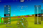
    Had a chance to fly with my iPad and the WingX app this morning. In a word. . . Fantastic. I see no reason to give Garmin any more of my money. I used the app to circumnavigate under and around the complex DFW Class B, and it was great to be able to see EXACTLY where I was on the "sectional" sitting on my leg. I really don't see a need to mount the iPad, as it seems to take up the least room sitting on my knee. The iPad's built in GPS (first generation unit) did a fine job. The most error I saw was 31'. I just don't think an external GPS module is going to be needed.

    BTW, I figured out "rubber-banding" the course line. You simply touch the screen where you want to create the new waypoint and the course lines jumps to it. The point is automatically added in the correct position to your route.

    I'm going to try out ForeFlight, but really, I don't see how it can get any better than this. Okay, one thing. I want to be able to switch to "Track Up", where the sectional is oriented in the direction I'm going. Currently, it's "North Up". Their reasoning may be that the chart is always readable, but it would be nice to switch back and forth and not have to rotate the iPad.

    In the end, I think this package is a bargain. Sure you have to buy an iPad, but that's a no-brainer. If you don't own one, you should. You'll wonder how you ever did without it. At $100 a year it would take about six years to equal the cost of a stand alone unit, and that's not to mention the cost of map updates. Who knows what they'll come up with six years from now!

  2. #2

    Default Re: So Long Garmin!

    What kind of inflight weather can you get with the ipad?
    Dj Series 6

  3. #3
    Senior Member Av8r_Sed's Avatar
    Join Date
    Feb 2010
    Location
    10C Greenwood, IL
    Posts
    671

    Default Re: So Long Garmin!

    So far, no practical in-flight weather solution has been fielded for the iPad/ iPhone. Baron services has hardware that takes data from a WxWorx receiver and makes it available to the mobile device via Wi-Fi. https://www.baronservices.com/aviati...ght/mobilelink Problem is that no current app like Foreflight or WingX Pro supports it yet. It is also going to be an expensive proposition, exceeding the cost of the iPad and app subscription.

    Best advice for now is to wait and monitor new developments. Apple is starting to loosen up a bit on their tight control of interfaces to the IOS devices which should enable other solutions soon.

    --Paul S

  4. #4

    Join Date
    Feb 2009
    Location
    Grapevine, TX
    Posts
    7

    Default Re: So Long Garmin!

    Quote Originally Posted by hansedj View Post
    What kind of inflight weather can you get with the ipad?
    WingX (and I believe, ForeFlight) uses an external ADS-B receiver to obtain inflight weather radar. Unfortunately, the receiver is $1,000, so out of my price range. The good news is there is no subscription, like with XM radio.

    With a Cell signal, you can download lots of weather and even file a flight plan through DUAT.

  5. #5
    Super Moderator Av8r3400's Avatar
    Join Date
    Jan 2009
    Location
    Merrill, WI
    Posts
    3,046

    Default Re: So Long Garmin!

    I use Pilot My-Cast on my iPhone. Realtime weather (XM is not) and great flight planning functions. $100 annual subscription rate.
    Av8r3400
    Kitfox Model IV
    The Mangy Fox
    912UL 105hp Zipper
    YouTube Videos

  6. #6
    Senior Member Dorsal's Avatar
    Join Date
    Sep 2008
    Location
    Central, MA
    Posts
    1,511

    Default Re: So Long Garmin!

    How do you get realtime weather at altitude, my phone (I also use MyCast) coverage gives up around 3000 ft.
    Dorsal ~~^~~
    Series 7 - Tri-Gear
    912 ULS Warp Drive

  7. #7
    Senior Member Peteohms's Avatar
    Join Date
    Sep 2008
    Location
    Leander, TX Hangared @ KGTU
    Posts
    272

    Default Re: So Long Garmin!

    Quote Originally Posted by Jbonewitz View Post
    ?.........

    I'm going to try out ForeFlight, but really, I don't see how it can get any better than this. Okay, one thing. I want to be able to switch to "Track Up", where the sectional is oriented in the direction I'm going. Currently, it's "North Up". Their reasoning may be that the chart is always readable, but it would be nice to switch back and forth and not have to rotate the iPad.
    The iPad has a feature of locking the screen orientation so that once locked you can turn your pad any direction and can turn it to show "Track Up".

    Pete Christensen
    Leander, Tx
    Kitfox iii, 912
    Pete
    Leander, TX
    Model III SN 1000
    912
    Grove

  8. #8
    Super Moderator Av8r3400's Avatar
    Join Date
    Jan 2009
    Location
    Merrill, WI
    Posts
    3,046

    Default Re: So Long Garmin!

    I've never used it aloft, to be honest. It is a preflight planning tool for me.
    Av8r3400
    Kitfox Model IV
    The Mangy Fox
    912UL 105hp Zipper
    YouTube Videos

  9. #9
    Senior Member DanB's Avatar
    Join Date
    Jun 2008
    Location
    Mesa, AZ
    Posts
    542

    Default Re: So Long Garmin!

    Interesting thread. I like many of the applications that have come out for the I Pad but as Dorsal brought up, I hesitate to take this plunge yet when you are relying on only cell coverage. Even though XM weather is not real time (maybe 3-5 min lag time), I have found it to work well enough and it is quite reliable.
    I guess I am playing devils advocate here so I will bring up a couple other possible negative aspects with the I Pad...these things were what I observed a little more than a year ago (hopefully they have been addressed).
    The screen being bright enough in full sunlight
    &
    When temperatures exceeded 90 degrees F, reports were that it shut down.
    This one turned my head the other way quickly as I live in the desert SW.

    If anyone could bring me up to speed having first hand experience with these issues (knowing they have been fixed) it would be helpful to many that are reading this and thinking about jumping into this technology.
    Last edited by DanB; 10-03-2011 at 06:19 AM.
    Dan B
    Mesa, AZ

  10. #10
    Senior Member
    Join Date
    Dec 2008
    Location
    Garland, Texas
    Posts
    1,476

    Default Re: So Long Garmin!

    I flew from Mesquite Texas to Weyerscave Virginia using my IPad. I have an IPad II, I use the foreflight software, with weather. On the trip back, I had it on and running for 10 hours only turning it off twice while I refueled. On the trip back the weather was BAD. I was near Montgomery Alabama, if I could get through a hole in between two rain storms, I would have clear sailing to Dallas. I checked the weather just Before I left, I could fly between two storms about 50 miles apart one was just rain and the one to the North had some lightning. As I flew the weather proceeded to get worse and worse, the airport I was suppose to land at was socked in. I started to fly to the next airport on the flight plan. I decided to check the weather, it was slow to load 3G speed. As I flew to the next aircraft, the weather came up. The hole I flew through had closed up, and it showed my next airport was clear. I am sold on this thing! I landed in Mesquite about 30 minutes prior to dusk. I plan on using Wing X Pro for my next flight.
    Paul Zimmermann
    LSRM-A
    Garland, Texas

Posting Permissions

  • You may not post new threads
  • You may not post replies
  • You may not post attachments
  • You may not edit your posts
  •